This case study is also available in German.
A+S Umwelt Energie, based in Berlin and Brandenburg, offers IT-related services in the planning and approval of linear infrastructure projects. A+S works for various clients in the energy market, such as TenneT TSO in Germany, 50 Hertz Transmission GmbH, and Arcadis. The team, with its many years of experience, employs the Pathfinder in project work in collaboration between environmental planners, surveyors, and clients, and supports, among other things, with the following tasks:
Methodological and professional project support
- Setting up and coordinating the Pathfinder project platform
- Project and cross-section method harmonization
- Recommendations and suggestions for the classification of geodata in the Pathfinder
- Rapid execution of data analyses
Processing and visualization of geodata in the Pathfinder
- Quality assurance of data and results
- Optimization of geodata (data processing, reduction of data volumes)
- Visualization of data and scenarios
- Early conflict detection, risk mitigation
- Quality assurance of data and results
Calculations and presentations of:
- Resistance-distance analyses
- Resistance maps and suitability maps for structuring the study area
- Recommendations for identifying alternative routes along with example routes
- Calculations of area proportions and permeability of paths and corridors
- Evaluation of suitability and representation of possible bottlenecks
Field appointments
- Use of the Pathfinder during site inspections for direct assessment of the situation on-site
- Participation in specialist and working meetings, official appointments, and public events
Challenges in Projects
Finding suitable routes and spaces for infrastructure projects is a significant challenge. The evaluation and prioritization process is time-consuming. The complex project procedures in Germany and the high level of coordination required set the framework for investigations, for example, in the following areas:
- Human: Distances to residential areas and residential buildings must be maintained.
- Environment: Handling and assessment of protected areas with regional, national, and international significance.
- Spatial planning: Various factors from spatial planning such as priority areas restrict the search.
- Costs: Careful consideration between conflict-free and cost-effective alternatives is important.
Project-supportive work in the Pathfinder
From the very first day, the A+S team contributes significantly to the projects. Software-supported coordination of tasks and additional cross-project, rapid data processing enable project acceleration. The substantial and dynamic coordination effort, along with demanding data management, is made more transparent by the coordination and visualization tool, Pathfinder, contributing to planning security.
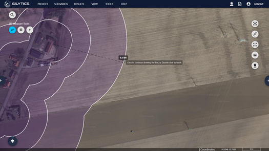
In particular, the quickly implementable and planning-supportive results from the Pathfinder allow project participants to make targeted decisions. Decision-making bases are partly reinforced and secured through scenarios, which simulate various project assumptions in advance and highlight resulting conflicts early on. Additional calculation and analysis capabilities, along with visualizations, support all project participants.
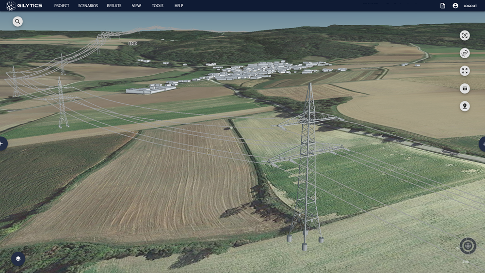
With the Pathfinder, a tool is available to visually prepare for and follow up on official appointments. Its use in official appointments is also effective, as it allows for the visualization of complex issues. This approach enables rapid decision-making and offers significant potential for acceleration while maintaining high planning quality.
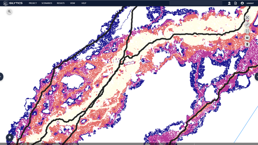
In the projects, different data layers are used. The data is buffered, and spatial resistance values are assigned to each buffer. The table provides examples of specific areas:
| Urban areas (inner district) | Buffer distances | 100m | 200m | 300m | 400m |
| Resistances | 5 | 4 | 3 | 2 | |
| Urban areas (outer district) | Buffer distances | 100m | 200m | ||
| Resistances | 5 | 4 | |||
| Flora and Fauna Habitats (FFH) | Buffer distances | 50m | |||
| Resistances | 4 | ||||
| Forest areas | Buffer distances | 30m | |||
| Resistances | 3 | ||||
| Existing linear infrastructure | Buffer distances | 30m | 100m | ||
| Resistances | 4 | -1 |
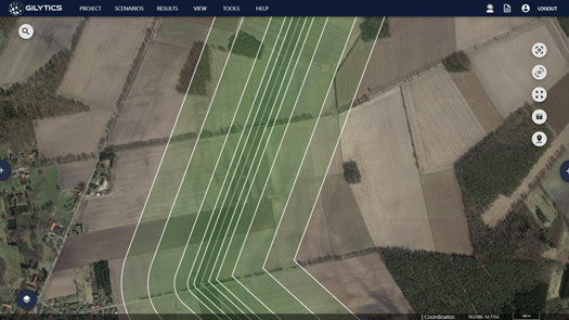
Based on the table defined above, A+S can calculate spatial resistance maps, corridor maps, example routes, and various data analyses (lengths, areas, costs, etc.) in the Pathfinder. Even staggered buffer distances are easily achievable. By incorporating negative spatial resistances parallel to linear infrastructures, the bundling requirement can be factored into the scenarios.
Advantages
- Acceleration
- … through rapid data preparation and processing
- … through delineation of search spaces
- … through early conflict detection
- Decision support
- … through visualization of complex issues
- Planning security
- … through collaboration of all project participants on a common project platform
- Risk mitigation
- … through early detection of conflicts