Our Pathfinder Platform can be used in types of linear infrastructure projects to optimize routing of cable, oil and gas, pipe, powerlines, renewables, roads, telecom, transport and water as well as by energy agencies and governmental bodies.
Learn more about how we work with different industries.

Engineering & Renewables

Power Utilities

Transportation
Get the results you need

Leadership and Finance
Engineering
GIS data analysT
Environmental management
Stakeholder engagement & communication
Leadership & finance, project management
Engineering
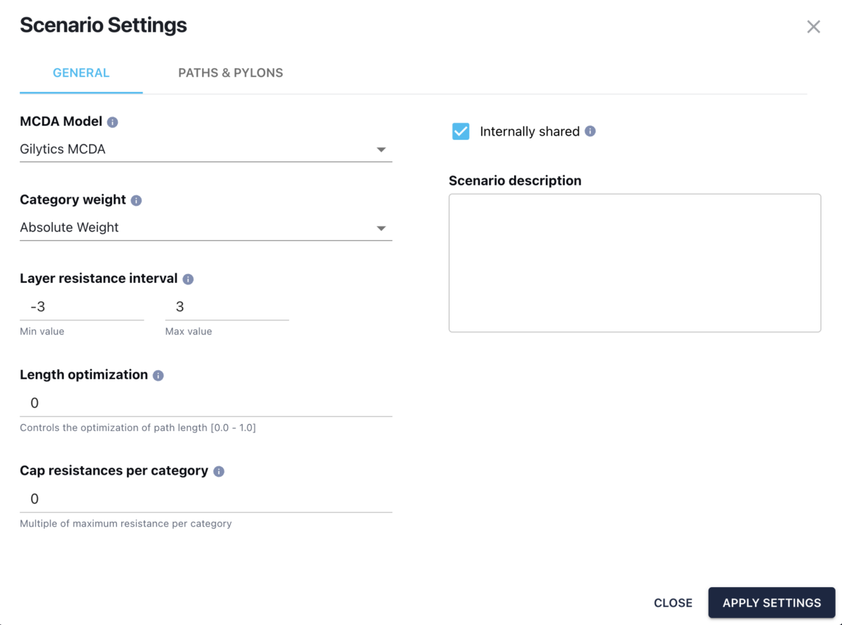
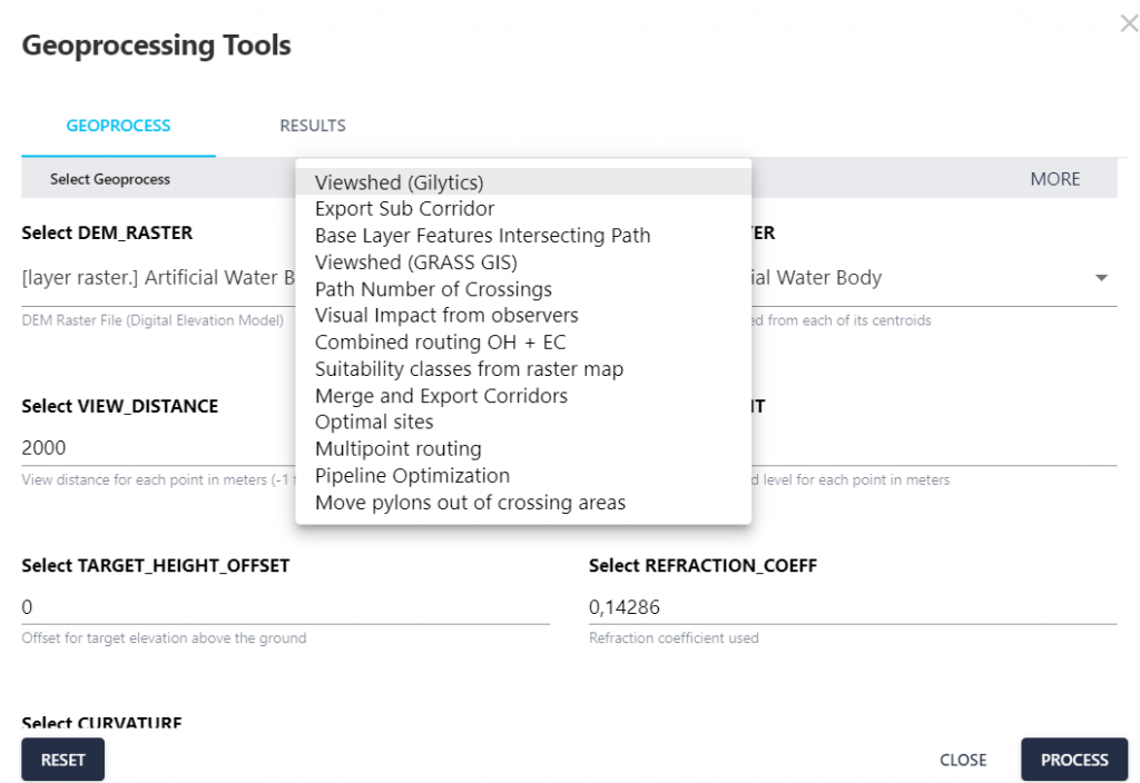
With Pathfinder’s rapid scenario generation and analytical capabilities, engineers can swiftly compare alternatives, gaining comprehensive insights that cut down on months of evaluation into seconds and minutes.
GIS data analyst
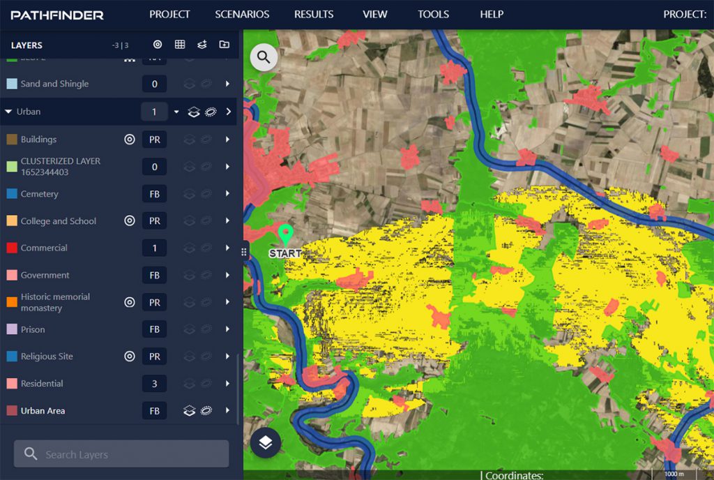
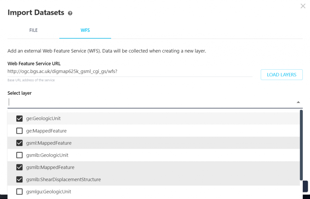
Our GIS layer classification and interactive tools bridge the data utilization gap, fostering strategic decision-making without the need for additional software
Environmental management
Leverage Pathfinder powerful geospatial data analysis tools to streamline the evaluation of environmental factors, enabling a more efficient and accurate assessment process
Stakeholder engagement & communication
Overcome the traditional challenges of infrastructure project communication, fostering a transparent, engaged, and
cooperative project environment.
Efficient energy planning and approval processes are crucial for advancing the energy transition and electrifying industries. Gilytics’ Pathfinder provides a data-driven solution for strategic power grid asset planning, enabling faster, streamlined and hence more cost-efficient project delivery. At RWTH Aachen University, we are pleased to welcome Gilytics as a member of the Research Association for Energy (Forschungsgesellschaft Energie, FGE), contributing to the further development of the energy sector and speed-up of the energy transition.
Institute of High Voltage Equipment and Grids, Digitalization and Energy Economics (IAEW) RWTH Aachen University Fraunhofer Center Digital Energy
Prof. Dr. Andreas Ulbig

We had the great opportunity to test and use Gilytics Pathfinder in our large-scale transmission line projects in Germany. The software is intuitive and offers great advantages in corridor identification and routing, especially if you work with multiple geodata. Gilytics’ Pathfinder definitely speeds up planning processes for several weeks up to months depending on the existing know-how and the project requirements. In particular, for users who do not program themselves, the software represents an enormous benefit, as the nocode environment is easy to handle. So Gilytics’ Pathfinder provides almost every team member with a possibility to calculate corridors as an estimate for optimal routing in planning phases. Results can be visualized, documented and easily exported. This way, team capacities can be distributed much more flexibly, and a lot of time can be saved.
Arcadis Germany GmbH
Frank Dünkel
Head of Digital Solutions
Gilytics allowed us to challenge our current way of working in our digitalization process. The close collaboration helped us to build up knowledge and improve our engineering services. This is another step forward to drive the transition to a clean energy future.
Axpo Grid AG / DSO Switzerland
Thomas Frey
Head Projects and Offers
The 3D Decision Support System improves public involvement in grid expansion projects because it quickly computes alternative routes for new power lines. It makes line planning more efficient and more transparent which may lead to a better acceptance of the projects.
Swissgrid / TSO Switzerland
Joshu Jullier
Communication Manager
Pathfinder is a wonderful tool that allows us to search for an optimal route for a new project in a few mouse clicks. On the top of that, its flexibility and visual representation option makes it easy to enter into dialogue regarding alternatives with external stakeholders.
Elia Group / TSO Belgium
Ilse Tant
Chief Public Acceptance Officer
With Pathfinder we can save 3- 6 months planning time on our large projects in Germany. On our initial project, the results from Pathfinder aligned 95% with conventional methods which was great to see.
TenneT TSO Germany
Reinhard Hüttner
Project Manager

With Pathfinder, we have found an ideal tool to be able to calculate corridors or potential route paths for our clients in the preliminary planning of infrastructure projects. Our GIS experts appreciate the many configuration options and fast computation times, our partners the ease of use, and our customers the web access and timely results with comprehensive outcomes for decision-making.
A+S Umwelt Energie / Environmental Planner Germany
Thomas Schierbaum
CEO

Pathfinder provides the potential to improve and accelerate planning saving costly time. The more modern 3D visualization is very useful for 3rd party communication
Working together with the Gilytics team is a great experience. Pathfinder gives our team a comprehensive overview of different line options which makes the overall process more efficient and helps us to better manage project costs.
SBB / Rail Operator Switzerland
Thomas Erb
Asset Manager Energy Infrastructure
The use of Pathfinder is well received by project teams on both the client and contractor sides. The interactive representations of map data and project visualizations help identify project risks and facilitate discussions on solutions.
A+S Umwelt Energie, Berlin
Jakob Wanke
GIS and Routing Expert
Trusted by our clients