Quickly calculate, compare, and edit paths and sites to accelerate your project.

> 50% project planning cost saving
Minimize costly mistakes and save budget
Ensure that your investment in infrastructure projects is optimized, saving you money by automating your infrastructure planning and design

Sec/mins vs months/years
Speed up project timelines
Compare multiple scenarios quickly and efficiently with KPIs. Ensure that decision-making is accelerated, and your projects move forward at a faster pace

Communication transparency
Enhanced communication
Allow all stakeholders to get involved with access to data, information, and scenarios. Facilitate open discussions in line with stakeholders’ expectations, and achieve successful outcomes
Features
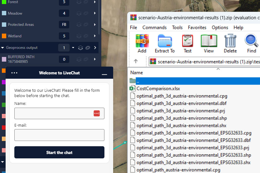
Data management
Add your own spatial data or leverage geodata available in Gilytics’ repository covering multiple countries. Ask Gilytics team for more information about global coverage.
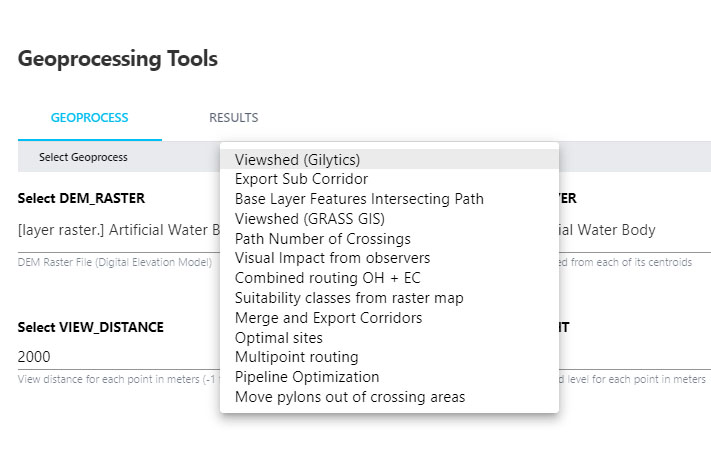
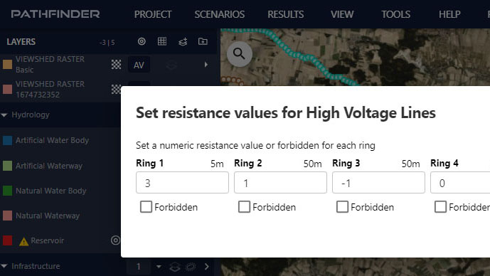
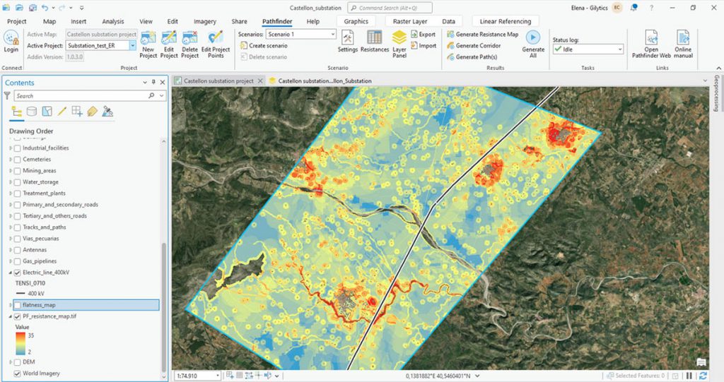
Optimization engine
Our in-house developed optimization engine helps users to quickly create multiple scenarios, and reduce planning, siting, and routing time from weeks/months to just minutes.
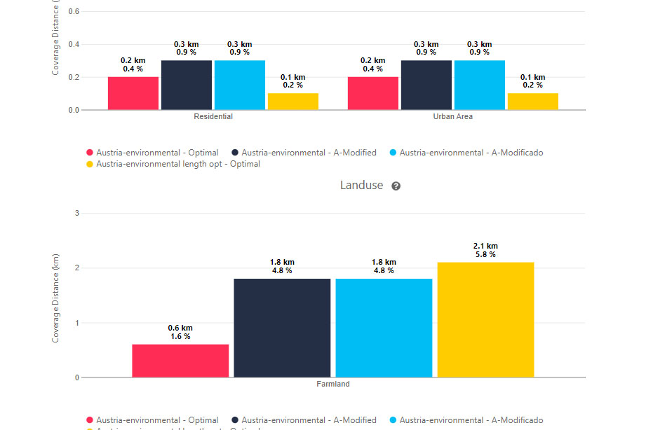
Analytics
Multiple analytics give users deeper insights and more quantitive comparisons to assess the viability of the alternatives.
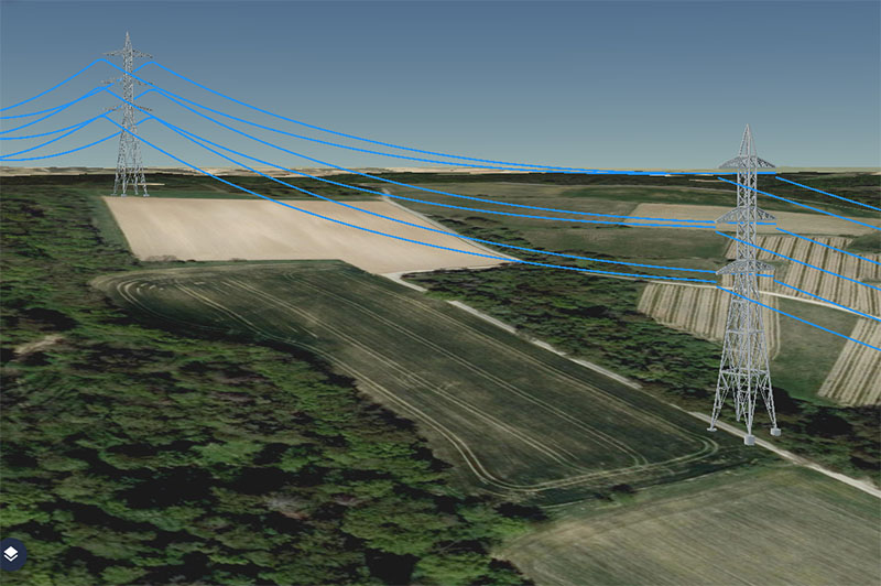
Visualization
Enhance communication with 2D & 3D visualizations and interactive analytical tools. Possibility of integration with augmented reality tools.
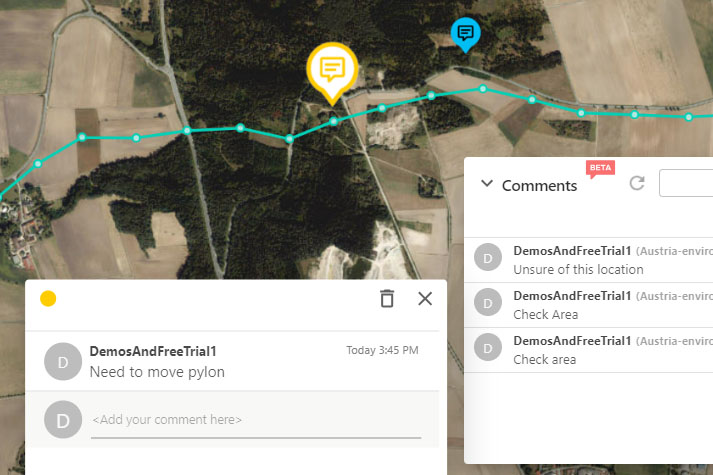
Transparency & collaboration
Share project scenarios and results with other departments and stakeholders. Collect feedback directly into project scenarios, identifying and addressing conflicts early reducing project delays and disputes.
User friendly & interoperability
Easy to use interface that requires NO prior GIS knowledge. Guided project setup and scenario parameter configuration. Seamless integration with GIS and (CAD) tools.
Seamless integration
Pathfinder is a stand-alone solution, but our routing and siting algorithms can seamlessly integrate into ArcGIS Pro.
Instantly connect your ArcGIS Pro account with Pathfinder.
Tennet achieves ultimate accuracy and saves time with Pathfinder
> 50% planning time saved
With Pathfinder we can save 3- 6 months planning time on our large projects in Germany. On our initial project, the results from Pathfinder aligned 95% with conventional methods which was great to see.
TenneT TSO Germany
Learn moreReinhard Hüttner
Project Manager

Contact Us
Our team is just one message away. Get in touch to discover how we can help with cutting-edge technology