Problem
Optimizing wind farm layouts is a complex process. It requires a multidisciplinary approach that considers technical, environmental, economic, and regulatory factors. Communication with teams and sharing alternatives is challenging and inefficient.
Solution
Our multipoint routing tool in Pathfinder helps wind farm developers and engineers to make planning more accessible, efficient and cost effective. Our user-friendly tool easily generates scenarios following different planning approaches, delivering results in hours instead of months.
Key Features
- Automate routing of feeder lines and grid connection route with easy digital workflow
- Fast configuration of project constraints and customizable weighting of key elements
- Advanced analytics showing detailed scenarios, measuring risks and costs with better data
- Dynamic and interactive 3D visuals to improve communication with communities and teams
Key Benefits
- Save time by creating multiple scenarios and project templates, getting results in minutes.
- Save costs by reducing hours spent in routes finding by external consultants and focus on analysis.
- Improve communication by sharing scenarios and results, adding and reviewing geo-comments from internal and external stakeholders.
- Make better data driven decisions
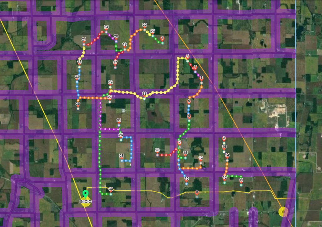
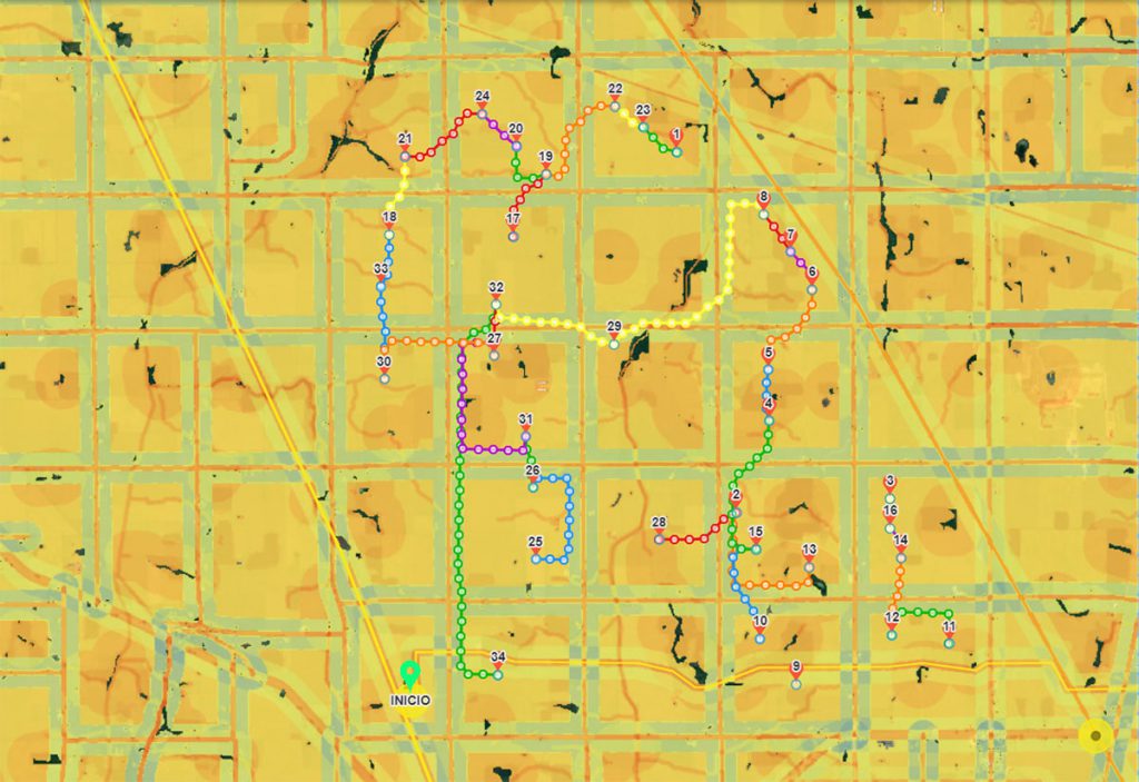
Automated routing of feeder lines
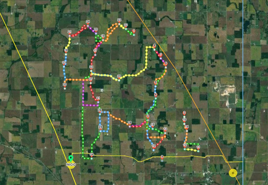
Our smart algorithms help planners identify connection alternatives for all turbines. It ́s also possible to exclude the connection between sets of turbines and include in the calculation existing lines. No need for GIS experience. Analyze spatial data in all formats for easy integration into existing tools.
Note: routing calculations shown exclude considerations for electricity capacity, voltage, etc.
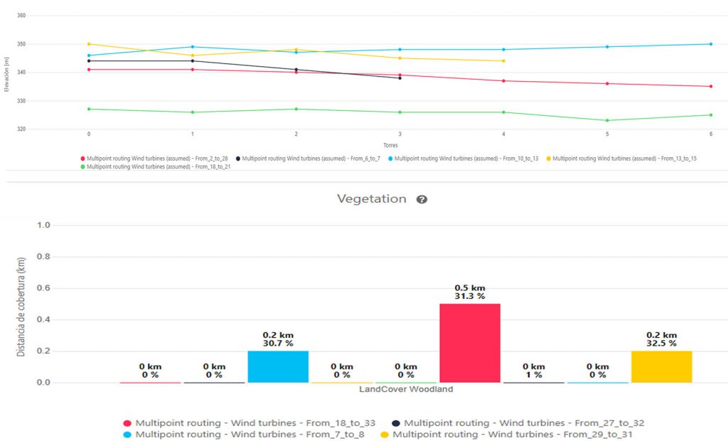
Decision support system using spatial data and easy to export analytics
Automatic and interactive generation of detailed analytics. Quantitatively and visually compare and rank multiple alternatives. Exportable graphics and tables help you better understand and communicate options in a more measurable, digital, and transparent way.
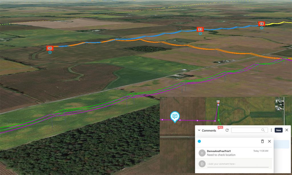
Public Communication Tool for transparent stakeholder engagement
Display your project in a 3D environment. Use Pathfinder to plan your project from 2D and 3D views for fast feedback. Interactively engage with your stakeholders, add geo-comment interactively, and transparently communicate project plans to authorities, communities, or individuals.