In the intricate world of infrastructure planning, GIS Leads are the backbone of the energy transition. These professionals manage the complexities of GIS data analysis – route planning – and infrastructure siting, often under intense pressure and with limited resources. Yet despite their critical role, GIS professionals are frequently overlooked when new planning technologies are introduced.
This article highlights the challenges GIS Leads face and explores how Gilytics Pathfinder – a leading transmission line planning and route optimisation software – helps them deliver faster, smarter, and more defensible results.
The Pain of Manual GIS Workflows
For many GIS Leads, manual GIS workflows remain a major roadblock. They must coordinate dozens of inputs across departments – from environmental data to technical constraints. Without standardised planning rules and clear methodologies, teams often encounter inconsistency, confusion, and last‑minute changes that trigger costly rework.
The result – delays, frustration, and a high risk of error. Traditional methods using spreadsheets, PDFs, and static maps simply cannot keep pace with the demands of modern grid expansion planning.
What GIS Leads Actually Want
Beyond speed, GIS Leads seek tools that provide:
– Automation and standardisation while respecting local regulations and workflows
– Interoperability with existing GIS systems such as ArcGIS and CAD tools
– Transparency in methodology and decision‑making
– Replicable frameworks to reduce subjectivity and error
– Data‑driven outputs with clear KPIs on cost, environmental impact, and compliance
– Flexibility to adapt to changing project requirements
– Visual outputs ready for stakeholder engagement and regulatory approval
These needs reflect the shift toward digital‑first, collaborative infrastructure planning.
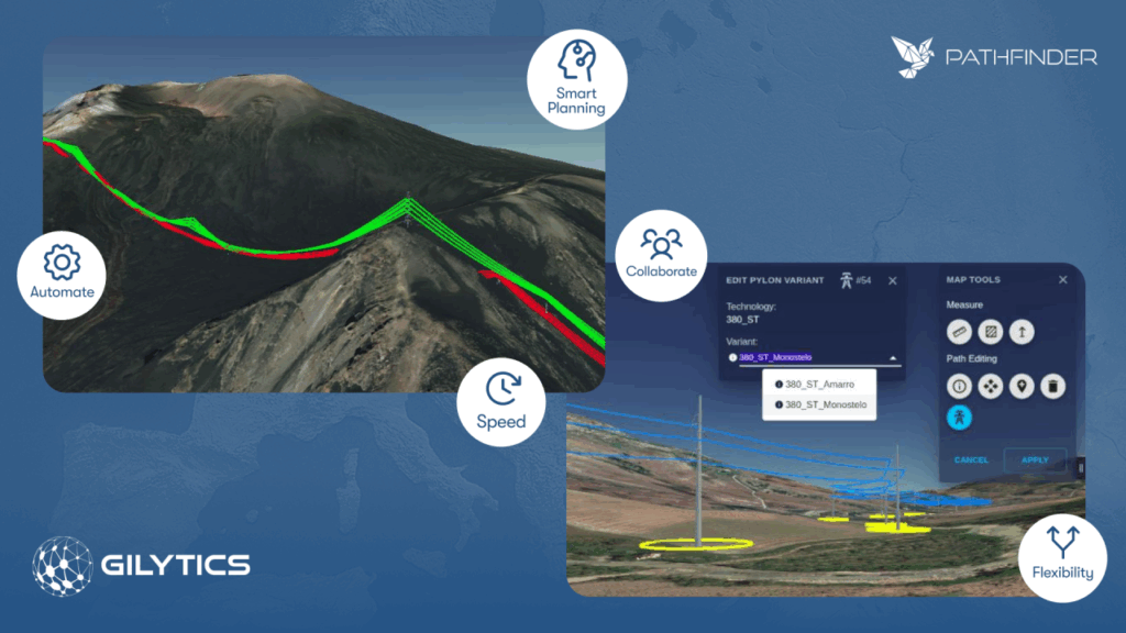
Smarter, Faster, Trusted – How Pathfinder Delivers
1. Smarter Infrastructure Planning
Gilytics Pathfinder enhances transmission line routing and linear infrastructure planning with multi‑criteria analysis and algorithm‑assisted decision‑making. GIS Leads can assign weighted rules – such as minimising environmental disruption or avoiding complex terrain, and instantly generate data‑driven alternatives.
2. Faster Route and Siting Analysis
With real‑time scenario generation, Pathfinder drastically reduces rework. GIS teams can make live adjustments, cutting planning time from months to days. Collaboration features replace endless email threads with shared digital workspaces, streamlining communication across departments and stakeholders.
3. Trusted and Transparent Results
Pathfinder ensures defensible decision‑making with transparent methodologies, version control, and audit trails. It integrates seamlessly with Esri ArcGIS Pro, CAD, and standard GIS formats – ensuring smooth adoption without disrupting existing workflows.
Bridging the Gap Between Innovation and Enablement
Unlike generic GIS tools, Pathfinder is built specifically for energy infrastructure planning. It acts as a collaboration layer between teams – providing flexibility for local nuances while handling the complexity of grid‑scale projects.
From underground cable routing to pipeline optimisation and substation siting – Pathfinder delivers results across the full spectrum of energy and infrastructure projects.
Planning Power Where It Belongs
GIS Leads deserve more than outdated tools and manual workflows. With Gilytics Pathfinder, they gain the ability to work faster, reduce risks, and make data‑driven decisions that stand up to scrutiny.
By equipping GIS professionals with advanced infrastructure routing software, we ensure that the backbone of modern grid planning is empowered to drive the sustainable energy transition.