Use it with your Pathfinder account.

Easily access and manage your data directly from ArcGIS.

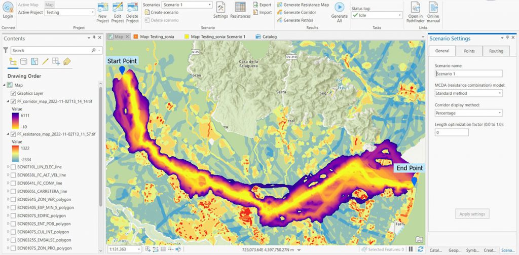
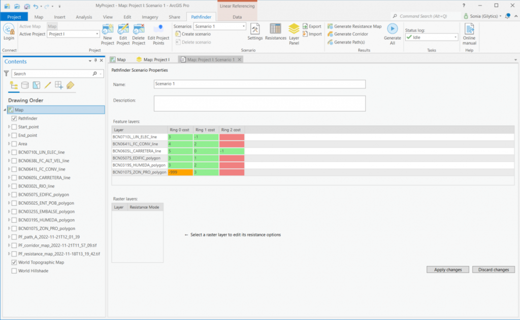
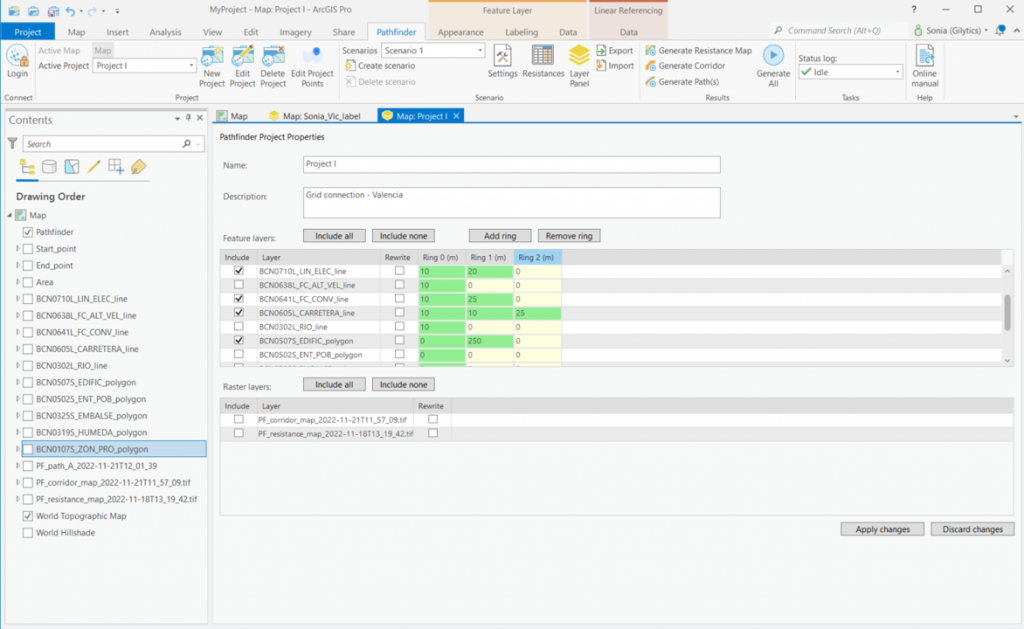
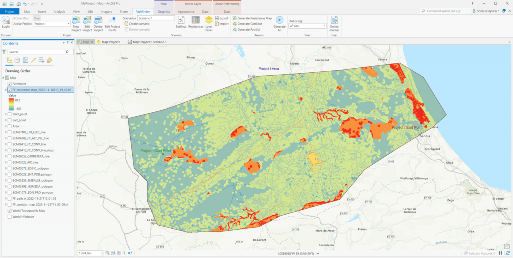
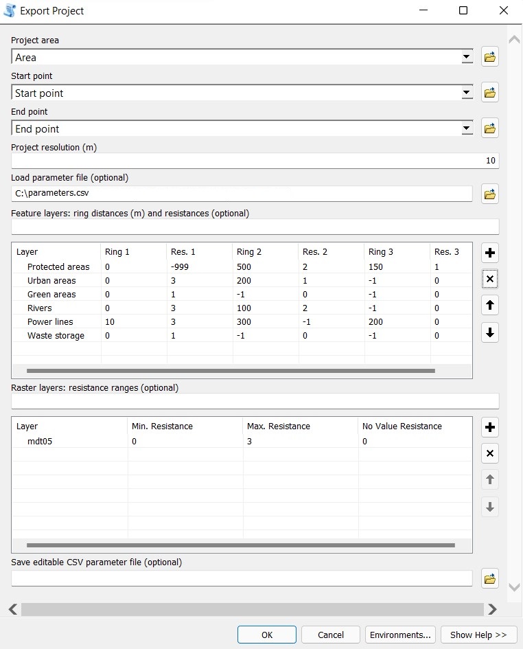
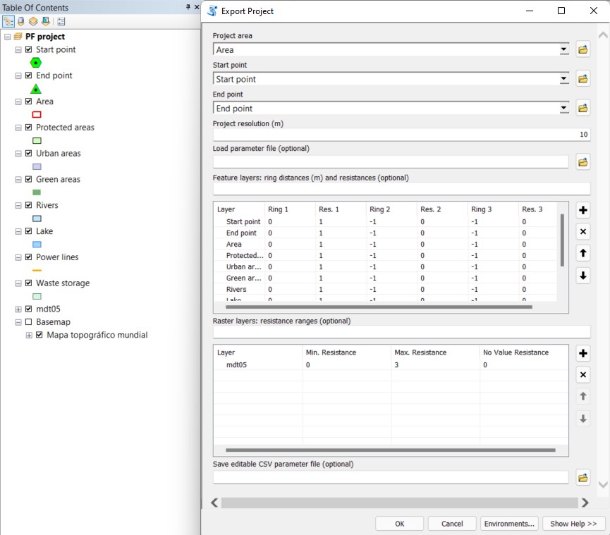
Create the scenario in a few clicks.

Apply the same planning rules and scenario configurations as in Pathfinder.

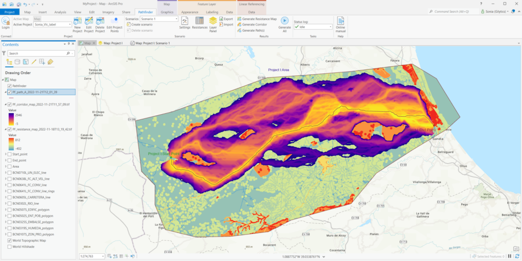
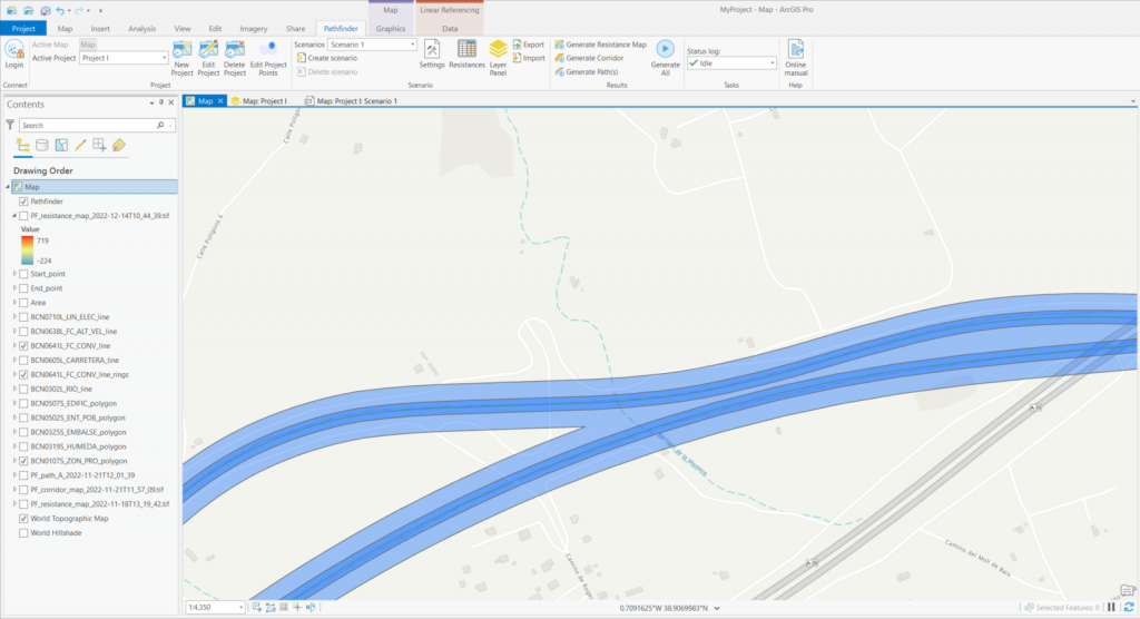
Calculate results directly in ArcGIS table of contents.

See your project in the Pathfinder and use its advanced analysis and reporting features.
Pathfinder ArcGIS Pro Workflow
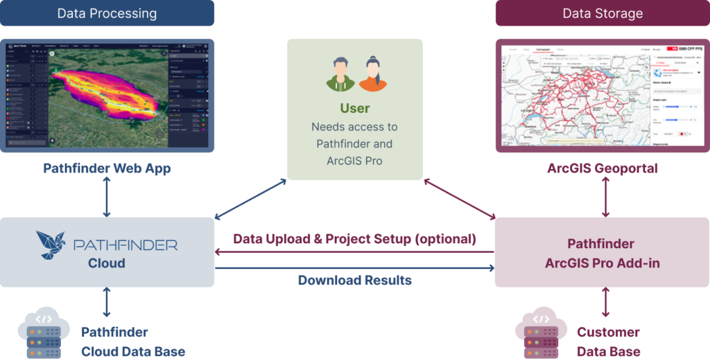
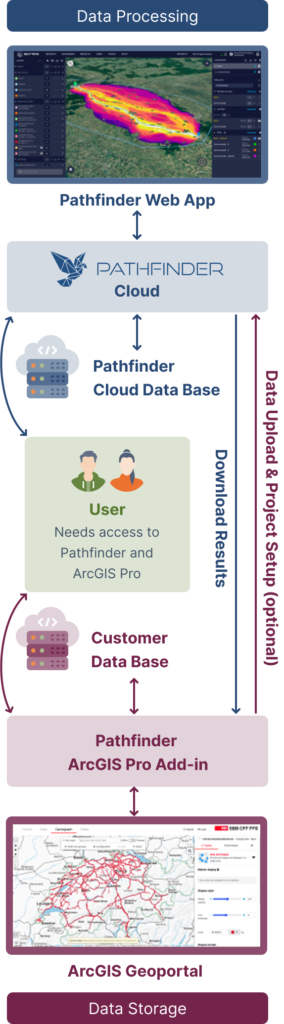

ArcGIS Pro Add-in
Full analysis workflow
Future versions
We had the great opportunity to test and use Gilytics Pathfinder in our large-scale transmission line projects in Germany. The software is intuitive and offers great advantages in corridor identification and routing, especially if you work with multiple geodata. Gilytics’ Pathfinder definitely speeds up planning processes for several weeks up to months depending on the existing know-how and the project requirements. In particular, for users who do not program themselves, the software represents an enormous benefit, as the nocode environment is easy to handle. So Gilytics’ Pathfinder provides almost every team member with a possibility to calculate corridors as an estimate for optimal routing in planning phases. Results can be visualized, documented and easily exported. This way, team capacities can be distributed much more flexibly, and a lot of time can be saved.
Arcadis Germany GmbH
Frank Dünkel
Head of Digital Solutions
Contact Us
Our team is just one message away. Get in touch to discover how we can help with cutting-edge technology